Geographic Information Systems Department - Henry County, Georgia Forms
The Geographic Information Systems Department in Henry County, Georgia is responsible for managing and providing access to spatial data, maps, and related information for the county. They use Geographic Information Systems (GIS) technology to collect, analyze, and visualize location-based data for various purposes such as land use planning, emergency management, transportation, utilities management, and decision-making processes. The department helps in creating and maintaining accurate and up-to-date maps and spatial data that is used by various county departments and the public.
Documents:
1
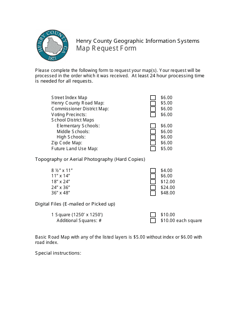
This form is used for requesting maps from the Henry County Geographic Information Systems in Henry County, Georgia.
