Geographical Information System - Warren County, Ohio Forms
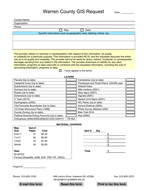
Geographical Information System (GIS) in Warren County, Ohio, is a technology that allows for the management, analysis, and visualization of various geographic data related to the county. It is used to collect, store, process, and display information about the county's features, such as parcels of land, roads, buildings, water bodies, and more. The system enables users to understand and make informed decisions about the county's resources, infrastructure, and development. It is utilized by government agencies, planners, emergency services, engineers, and others to improve the management and planning of Warren County.
Documents:
1
This document is a request form for accessing GIS (Geographic Information System) data for Warren County, Ohio.
