Mapping and Gis Office - City of Big Rapids, Michigan Forms
The Mapping and GIS Office of the City of Big Rapids, Michigan is responsible for managing and maintaining geographical information systems (GIS) and mapping data for the city. They handle tasks such as collecting, analyzing, and mapping spatial data to create interactive maps and provide various mapping services to the public, businesses, and government agencies. They also offer data licensing agreements and digital mapping order forms to facilitate access to their mapping and GIS resources.
Documents:
3
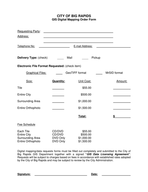
This form is used for placing an order for GIS digital mapping services from the City of Big Rapids, Michigan.
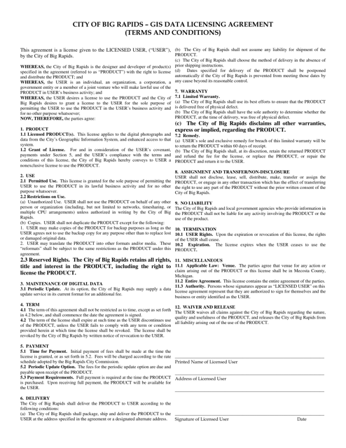
This document outlines the licensing agreement for GIS data provided by the City of Big Rapids, Michigan. It specifies the terms and conditions for using the data and any restrictions that may apply.
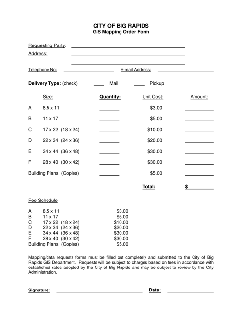
This form is used for placing a GIS mapping order with the City of Big Rapids, Michigan. It allows residents or businesses to request specific maps or geographic information.
