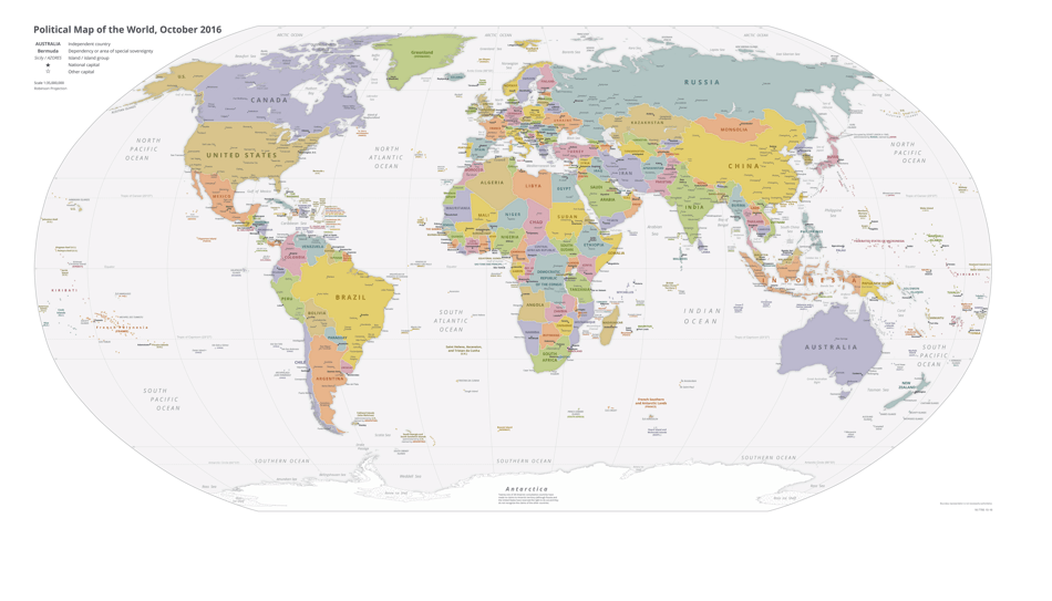
Political Map of the World

Political Map of the World is a 1-page legal document that was released by the Central Intelligence Agency on October 1, 2016 and used nation-wide.
FAQ
Q: What is a political map?
A: A political map is a map that shows the borders and boundaries of countries and states.
Q: Why is a political map important?
A: A political map is important because it helps us understand the organization of countries and states on a global scale.
Q: What does a political map show?
A: A political map shows the borders, capitals, and major cities of different countries and states.
Q: What is the difference between a political map and a physical map?
A: A political map focuses on boundaries and borders, while a physical map shows geographical features like mountains and rivers.
Form Details:
- The latest edition currently provided by the Central Intelligence Agency;
- Ready to use and print;
- Easy to customize;
- Compatible with most PDF-viewing applications;
- Fill out the form in our online filing application.
Download a printable version of the form by clicking the link below or browse more legal forms and templates provided by the issuing department.