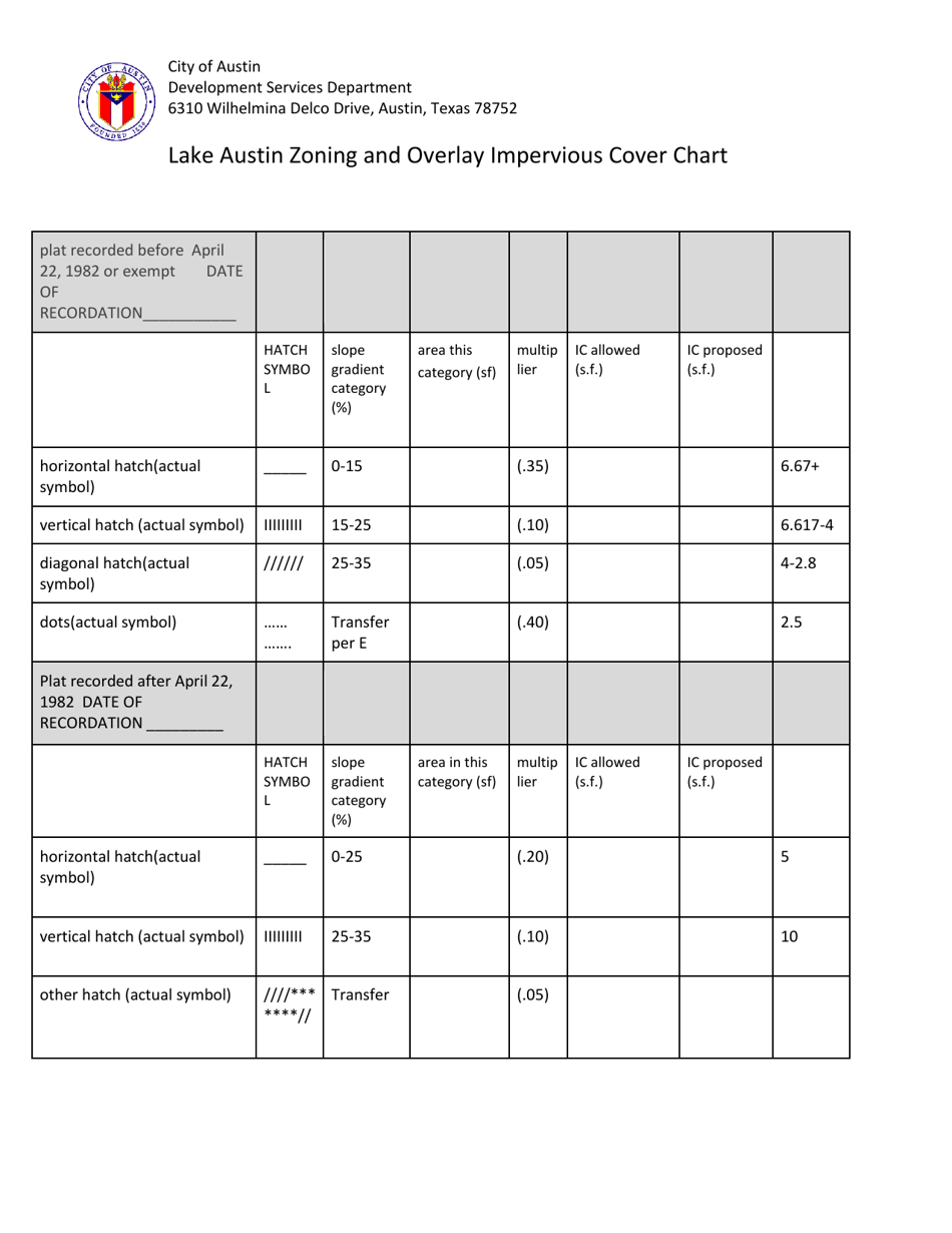
Lake Austin Zoning and Overlay Impervious Cover Chart - City of Austin, Texas
Lake Austin Zoning and Overlay Impervious Cover Chart is a legal document that was released by the Development Services Department - City of Austin, Texas - a government authority operating within Texas. The form may be used strictly within City of Austin.
FAQ
Q: What is the purpose of the Lake Austin Zoning and Overlay Impervious Cover Chart?
A: The purpose of the Lake Austin Zoning and Overlay Impervious Cover Chart is to regulate the amount of impervious cover allowed in development projects around Lake Austin in the City of Austin, Texas.
Q: What is impervious cover?
A: Impervious cover refers to any surface that prevents rainwater from soaking into the ground, such as concrete, asphalt, or rooftops.
Q: Why is regulating impervious cover important?
A: Regulating impervious cover is important to prevent stormwater runoff and protect the water quality of Lake Austin.
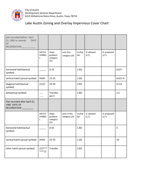
Q: What does the chart specify?
A: The chart specifies the maximum allowable impervious cover based on the zoning district and the proximity to Lake Austin.
Form Details:
- The latest edition currently provided by the Development Services Department - City of Austin, Texas;
- Ready to use and print;
- Easy to customize;
- Compatible with most PDF-viewing applications;
- Fill out the form in our online filing application.
Download a printable version of the form by clicking the link below or browse more documents and templates provided by the Development Services Department - City of Austin, Texas.