Longitude and Latitude World Map Template

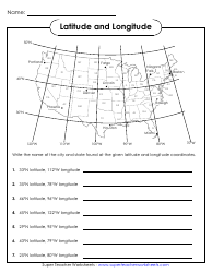
The Longitude and Latitude World Map Template is used to display the precise geographical coordinates of different locations on Earth. It helps in identifying the exact position of a place in terms of latitude (horizontal lines) and longitude (vertical lines).
The longitude and latitude world map template is not filed by a specific entity. It is a standardized reference tool used by cartographers, geographers, and other professionals to create maps and locate places on Earth based on the coordinates of longitude and latitude.
FAQ
Q: What is a longitude and latitude world map template?
A: A longitude and latitude world map template is a map that shows the lines of longitude and latitude, which are used to identify specific locations on Earth.
Q: Why is a longitude and latitude world map template useful?
A: A longitude and latitude world map template is useful because it provides a grid system that helps to precisely locate any point on the Earth's surface.
Q: How do you use a longitude and latitude world map template?
A: To use a longitude and latitude world map template, you can identify the desired location by locating the intersection of the lines of longitude and latitude.
Q: What are lines of longitude and latitude?
A: Lines of longitude and latitude are imaginary lines that crisscross the Earth's surface and help in determining the exact location of any point.
Q: What is longitude?
A: Longitude is the angular distance of a point east or west of the Prime Meridian, which runs through Greenwich, London.
Q: What is latitude?
A: Latitude is the angular distance of a point north or south of the Equator.