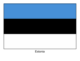
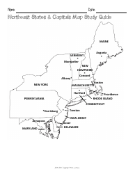
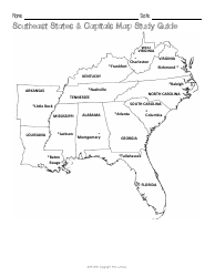
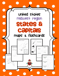
Estonia Map Template

The Estonia Map Template is a document used to represent the geography and boundaries of Estonia. It provides a visual representation of the country's regions, cities, and major landmarks.
FAQ
Q: What are the main features of an Estonia map template?
A: The main features of an Estonia map template usually include the country's boundaries, major cities, towns, and landmarks. Additionally, the template may show rivers, lakes, and other geographical features of Estonia.
Q: Can I customize an Estonia map template?
A: Yes, you can customize an Estonia map template according to your needs. Most map templates can be edited using graphic design software, allowing you to add or remove elements, change colors, and add text.
Q: Do I need graphic design skills to use an Estonia map template?
A: Having some basic graphic design skills can be helpful for customizing a map template. However, many templates also come with pre-designed elements that can be easily edited without extensive design knowledge.
Q: What file formats are commonly used for Estonia map templates?
A: Common file formats for map templates include Adobe Illustrator (.ai), Photoshop (.psd), and scalable vector graphics (.svg). These formats allow for easy editing and customization of the templates.
Q: Can I use an Estonia map template for commercial purposes?
A: The usage rights of map templates may vary depending on the source and license. Some templates are available for commercial use, while others may be restricted to personal projects. Make sure to check the license agreements before using a template for commercial purposes.
Q: Can I use an Estonia map template for educational purposes?
A: Yes, you can use an Estonia map template for educational purposes. It can be helpful for presentations, educational materials, or any other educational projects related to Estonia.