Land Development Templates
Welcome to our webpage dedicated to land development. Whether you are involved in real estate, urban planning, or construction, this is the place to find all the essential documents and resources you need for your land development projects.
Our extensive collection of documents covers various aspects of land development, ensuring that you have access to all the necessary information to successfully navigate through the planning and approval processes. From instructions for subdivision applications to restrictive covenant modifications, our documents provide step-by-step guidance and valuable insights.
One of our key documents is the "Instructions for Subdivision Application" which is applicable in the City of Austin, Texas, and Travis County. This document outlines the specific requirements and procedures for submitting a subdivision application in this area. Additionally, we also offer the "Restrictive Covenant Modification" document from Yolo County, California, which provides information on how to modify existing restrictive covenants to accommodate specific land development needs.
If you are looking to determine the land status or request a platting exception in the City of Austin, Texas, our "Land Status Determination Application - Platting Exception" document is an invaluable resource. It provides the necessary forms and guidelines for requesting modifications to land status in this jurisdiction.
For those planning minor subdivisions, replats, or lot splits in the City of Miamisburg, Ohio, our "Minor Subdivision/Replat/Lot Split Application" document is tailored to meet your needs. This document ensures you have all the required paperwork and understanding of the application process in Miamisburg.
Our collection also offers a range of documents specific to various counties and cities. An example is the "Form PDS040 Plot Plan Cover Sheet" from the County of San Diego, California. This document is essential for submitting plot plans and ensures compliance with local regulations.
With our comprehensive collection of land development documents, you can stay informed and streamline your processes. Our alternate names include "resources for land development," "land development forms," and "documents for real estate development," all of which represent our focus on providing the necessary tools and information for successful land development projects.
Browse our extensive collection of land development documents today and empower yourself with the knowledge you need for your next project.
Documents:
209
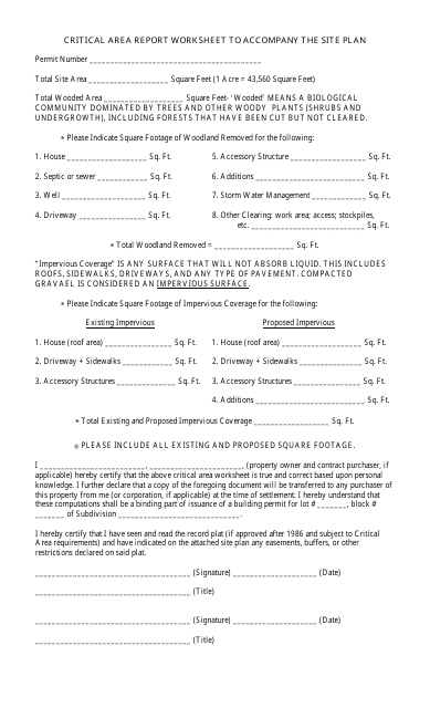
This document is used for preparing a critical area report worksheet that accompanies a site plan. It helps identify and assess the potential impacts of a proposed development on environmentally sensitive areas.
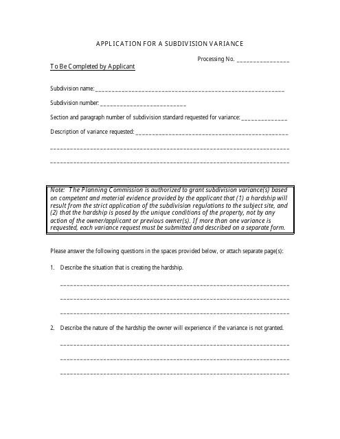
This document is used to apply for a subdivision variance, which allows for exceptions or changes to be made to the regulations and requirements for dividing a piece of land into multiple lots.
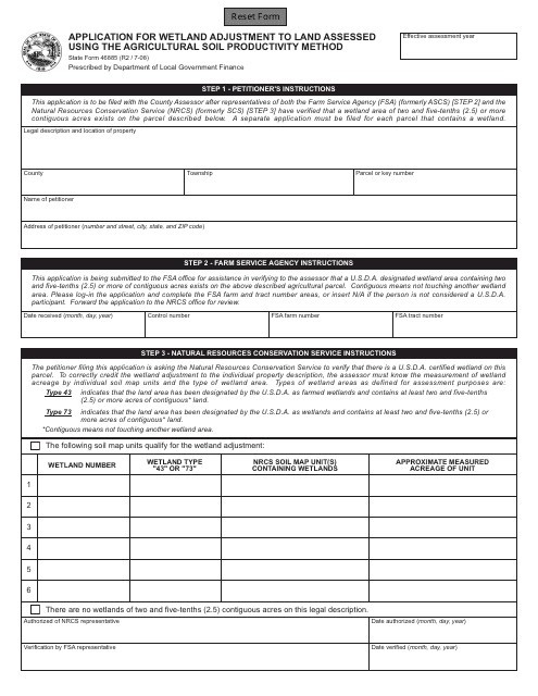
This form is used for applying for wetland adjustment to land assessed using the agricultural soil productivity method in the state of Indiana.
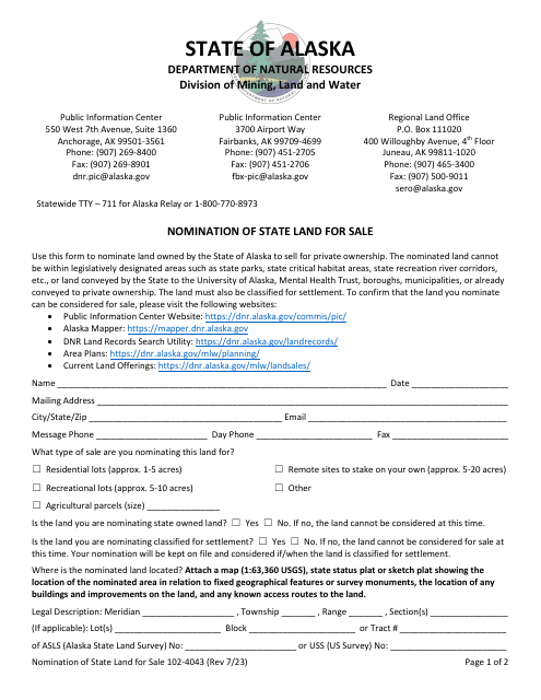
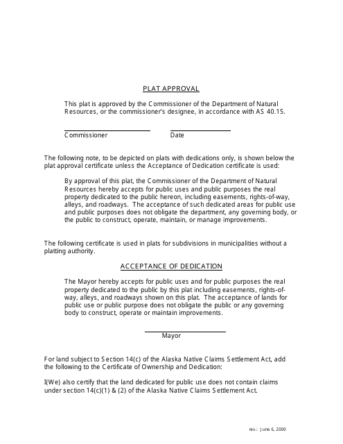
This document is used for approving plats and includes a legend specific to the state of Alaska.
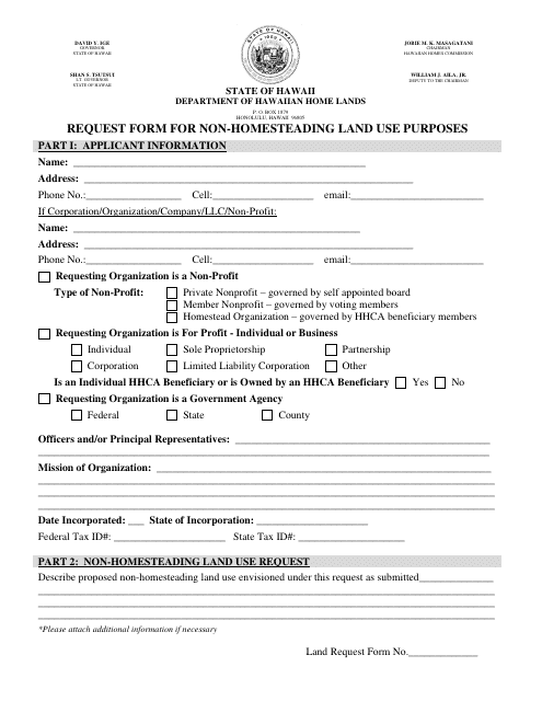
This form is used for requesting non-homesteading land use purposes in Hawaii.
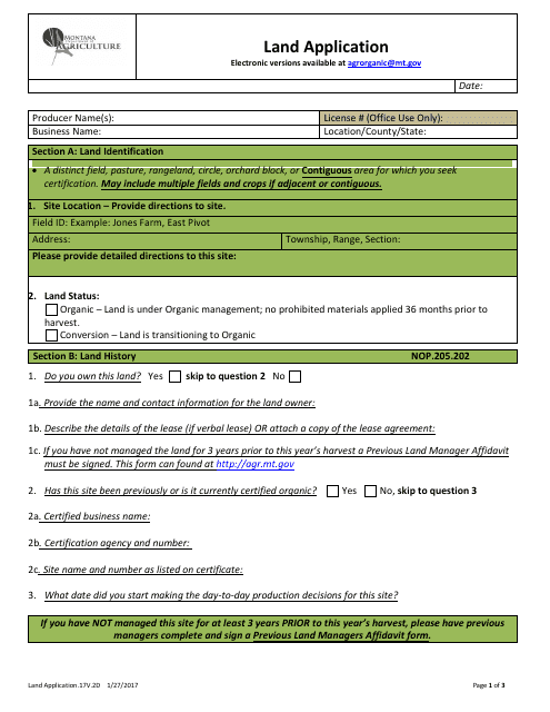
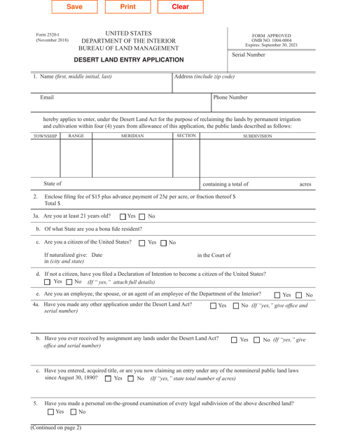
This Form is used for applying for land in Montana.
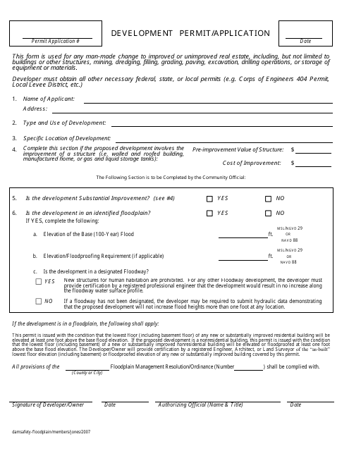
This form is used for applying for a development permit in the state of Nebraska. It is required for any proposed construction, renovation, or land use changes.
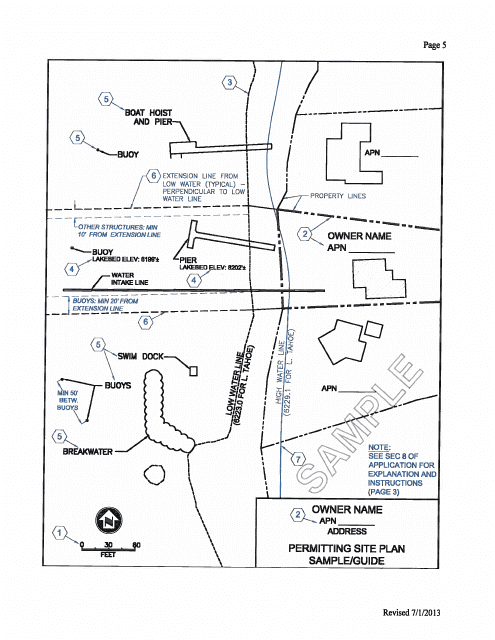
This type of document is a site plan used for permitting in the state of Nevada. It provides a visual representation of the proposed development or construction project.
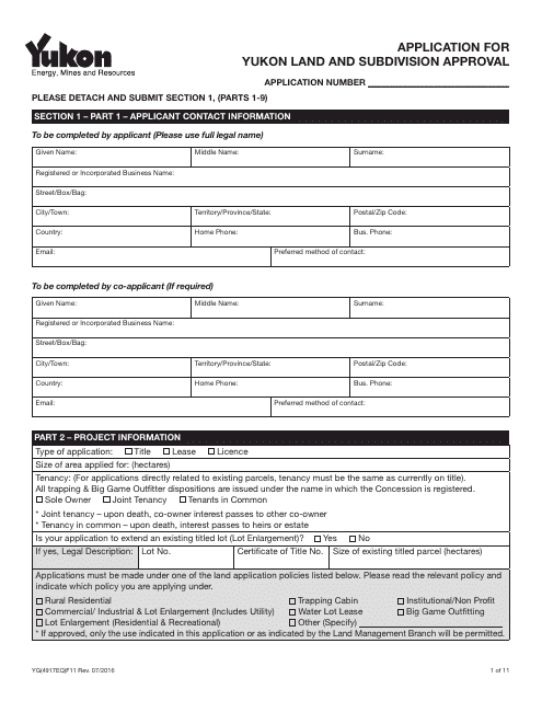
This form is used for applying for land and subdivision approval in Yukon, Canada.
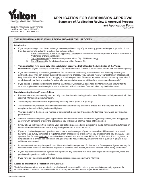
This Form is used for applying for subdivision approval in Yukon, Canada.
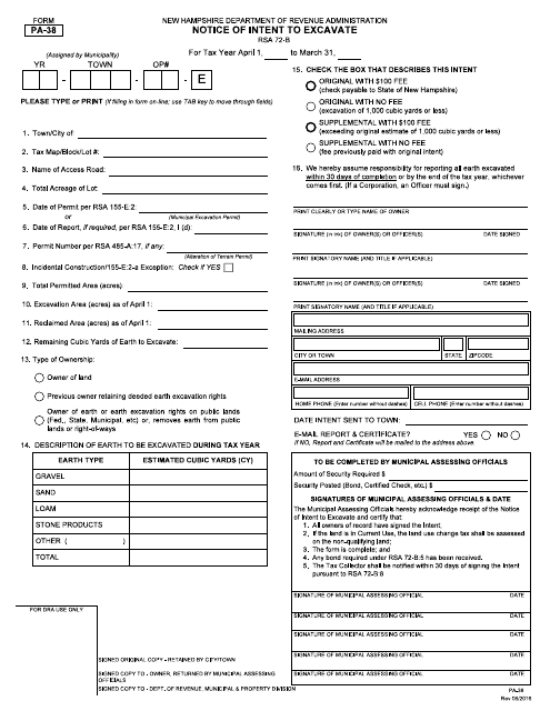
This form is used for notifying the relevant authorities in New Hampshire of the intent to excavate.
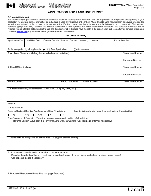
This form is used for applying for a land use permit in Canada. It is necessary if you want to use a piece of land for a specific purpose, such as building or development.
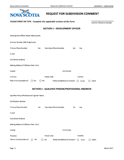
This document is used for submitting comments or feedback regarding a proposed subdivision in the province of Nova Scotia, Canada.
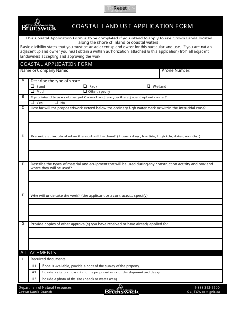
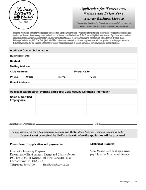
This Form is used for applying for land use along the coastal areas in New Brunswick, Canada.
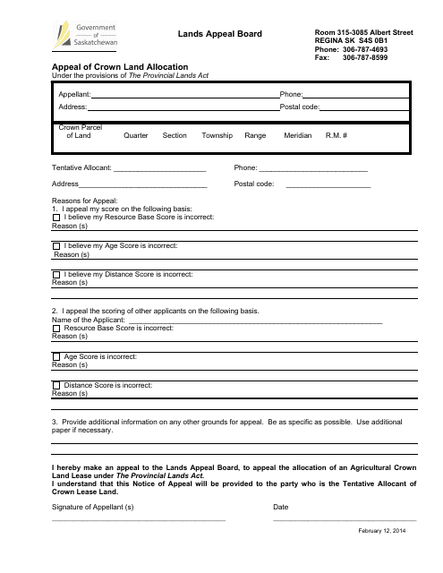
This document is for appealing the allocation of Crown land in Saskatchewan, Canada. It is used to challenge the decision made regarding the allocation of land by the government.
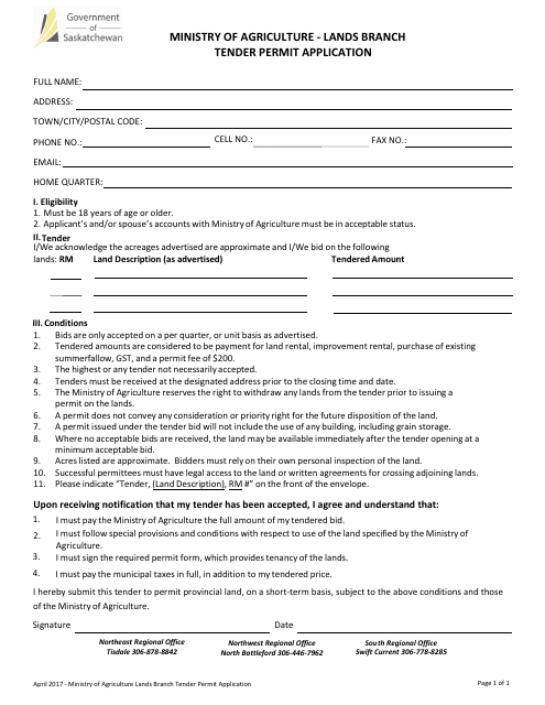
This document is used to apply for a permit to obtain crown land in Saskatchewan, Canada through a tender process.
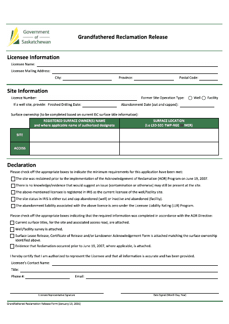
This document is for the purpose of releasing the reclamation obligations of an older mining operation in Saskatchewan, Canada.
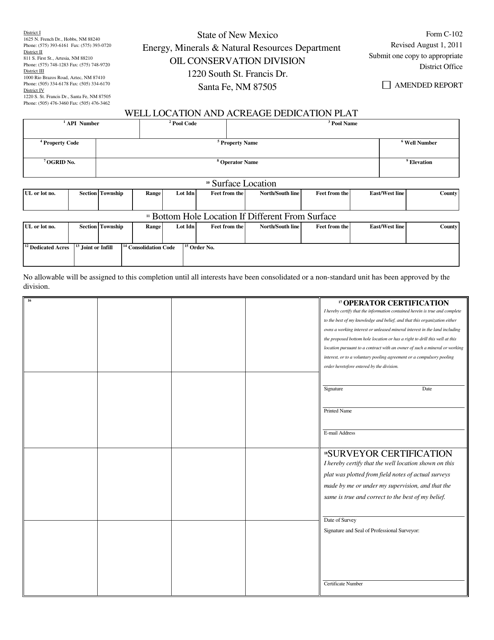
This form is used for submitting a well location and acreage dedication plat in the state of New Mexico.
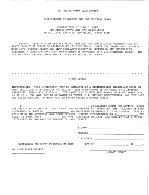
This document is used for appraising grazing and agricultural lands in the state of New Mexico. It provides a valuation of these types of properties for assessment and taxation purposes.
This form is used for applying for construction projects within public trust areas in North Carolina. It ensures that the structures being built comply with the regulations set by the state.
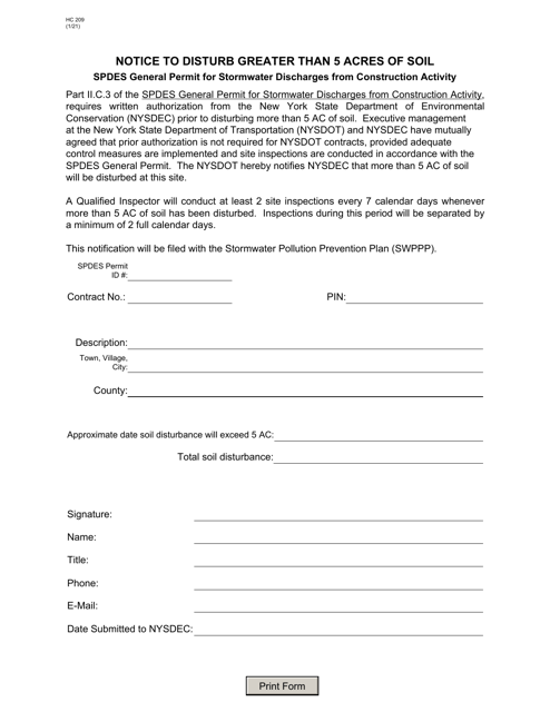
This form is used for designing erosion and sedimentation plans for small noncoal permits in special protection watersheds in Pennsylvania.
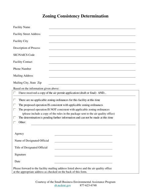
This type of document is used to determine the consistency of zoning regulations in North Carolina. It ensures that the zoning ordinances and regulations meet the required standards.
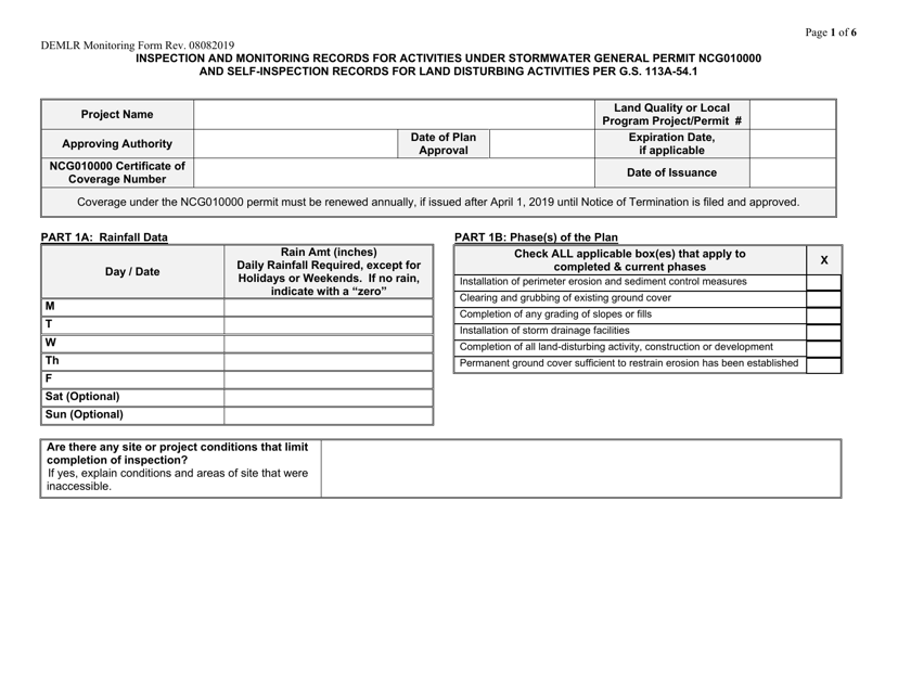
This Form is used for self-inspection and self-monitoring of land development projects in North Carolina.
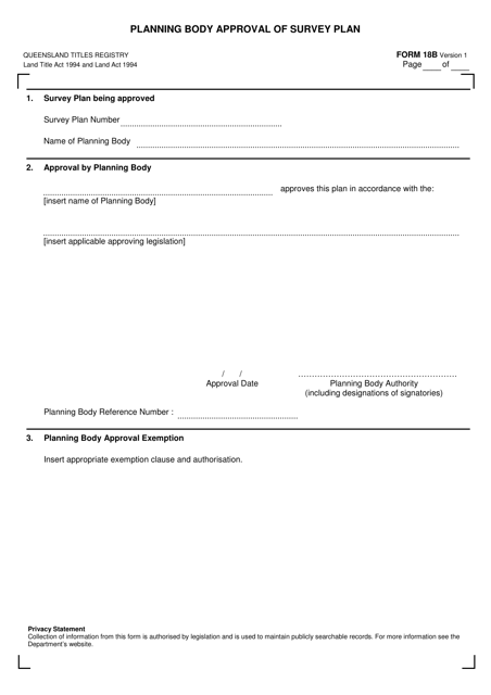
This form is used for obtaining approval from the planning body in Queensland, Australia for a survey plan.
This form is used for creating a plan of survey in the state of Queensland, Australia. It is required to accurately record and document detailed information about a piece of land, including its boundaries, measurements, and other relevant features.
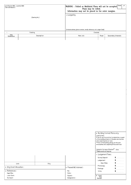
This document is used for the release of a covenant or profit a prendre in Queensland, Australia.
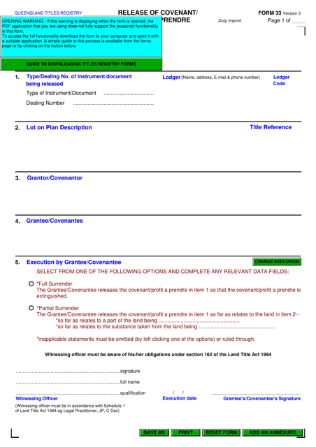
This form is used for applying for a minor permit in Volusia County, Florida.
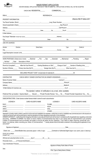
This document is for individuals in New Brunswick, Canada who are applying to acquire Crown land. Crown land is publicly owned land and the application process is necessary to gain permission for use or ownership of this land.
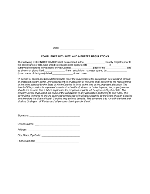
This document is for ensuring compliance with wetland and buffer regulations in North Carolina. It provides guidelines and requirements for activities near wetlands and buffers to protect the environment.
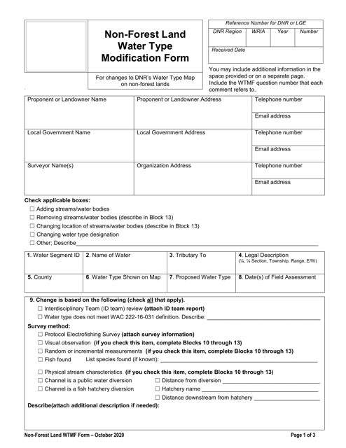
This document is used for requesting modification of water type on non-forest land in Washington state.
