Land Survey Templates
Welcome to our webpage dedicated to land surveying, also known as land survey. Land surveying is a crucial process that involves measuring and mapping land features to establish property boundaries, create accurate property records, and assist in land development projects.
Our collection of documents related to land surveying provides a comprehensive resource for individuals and professionals involved in surveying activities. Whether you are a surveyor, landowner, or developer, these documents offer valuable guidance, instructions, and forms to help you navigate the complexities of land surveying.
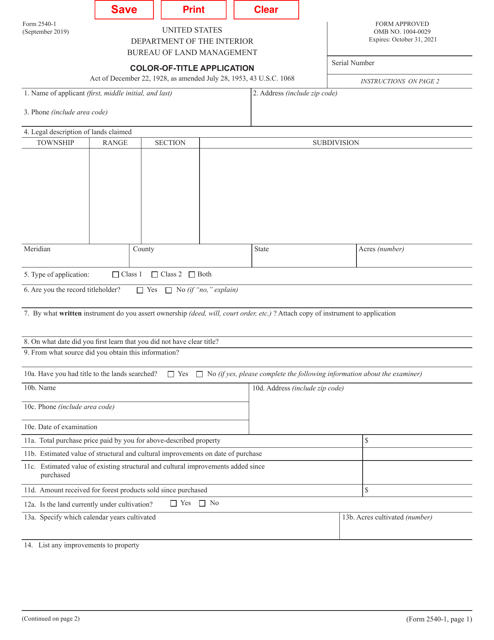
From Instructions for Form C-102 Well Location and Acreage Dedication Plat in New Mexico to the Surveyor Course Checklist in Texas, our documents cover a wide range of topics and regions. We also provide resources such as the Form 14 Certificate for Cadastral Plans & Corresponding Cadastral Information Files in Queensland, Australia, and application forms for various purposes, including New Water Easement and Plat Approval in different locations.
Our goal is to empower individuals and professionals in conducting accurate and reliable land surveys. By utilizing these resources, you can ensure compliance with regional regulations, streamline your surveying processes, and contribute to the efficient and responsible use of land.
Explore our comprehensive collection of land survey documents and enhance your knowledge and proficiency in land surveying. Whether you are looking for specific instructions, checklists, or application forms, our documents are designed to support your needs and help you succeed in your land surveying endeavors.
Note: The given document titles were not used in the text to demonstrate the versatility and flexibility of our documents' collection.
Documents:
83
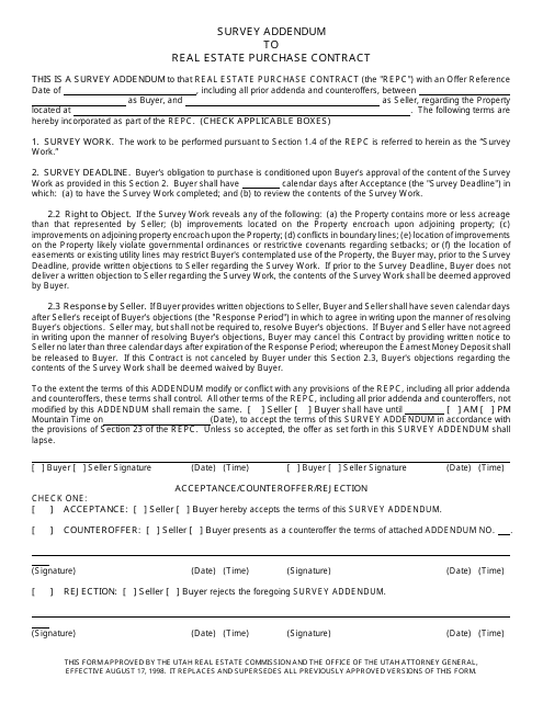
This document is an addendum to a real estate purchase contract in Utah. It is used to gather additional information through a survey.
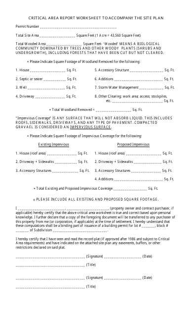
This document is used for preparing a critical area report worksheet that accompanies a site plan. It helps identify and assess the potential impacts of a proposed development on environmentally sensitive areas.
This document provides a description of public land states in the United States. It includes information about the type of land and its ownership.
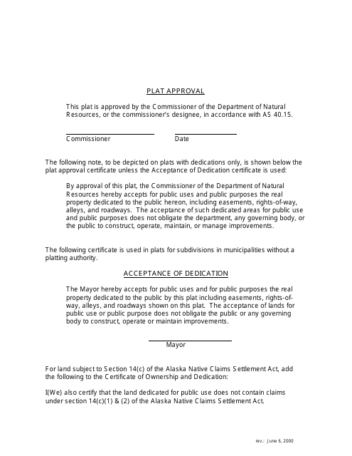
This document is used for approving plats and includes a legend specific to the state of Alaska.
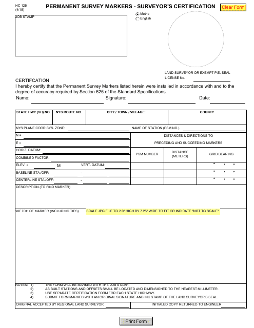
This Form is used for the surveyor's certification of permanent survey markers in the state of New York.
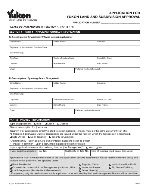
This form is used for applying for land and subdivision approval in Yukon, Canada.
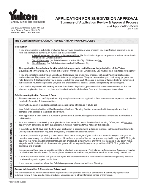
This Form is used for applying for subdivision approval in Yukon, Canada.
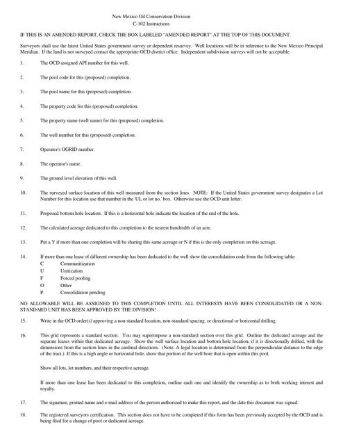
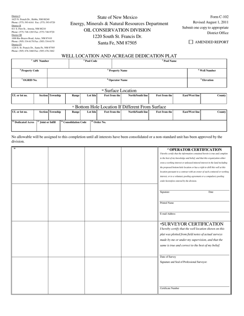
This form is used for submitting a well location and acreage dedication plat in the state of New Mexico.
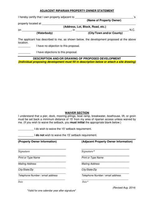
This document is used for recording the statement of a property owner who owns property adjacent to a riparian area in North Carolina. It helps document their rights and responsibilities related to the riparian area.
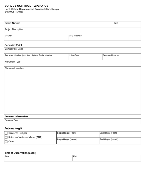
This Form is used for Survey Control in North Dakota using GPS/OPUS technology.
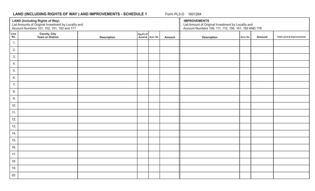
This form is used for reporting land, including rights of way, and improvements in the state of Virginia. It provides a detailed schedule for documenting these properties.
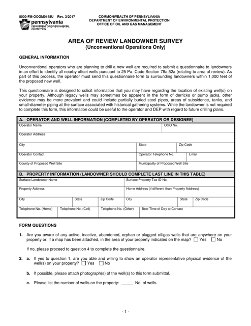
This Form is used for conducting a survey among landowners in Pennsylvania to gather information about the area of review for unconventional operations.
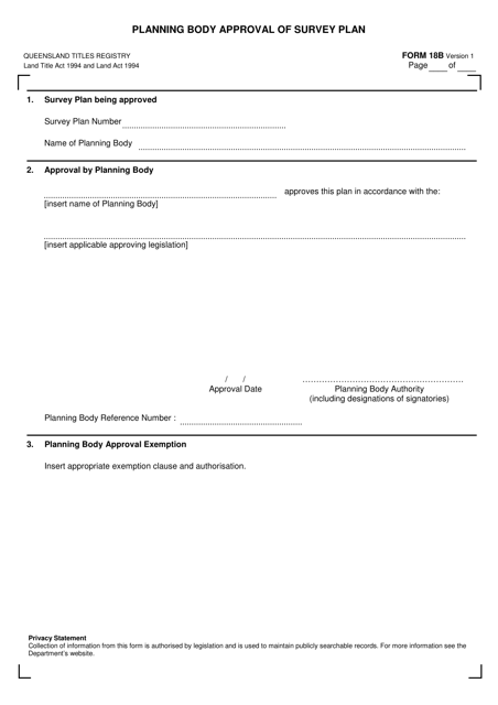
This form is used for obtaining approval from the planning body in Queensland, Australia for a survey plan.
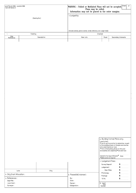
This form is used for creating a plan of survey in the state of Queensland, Australia. It is required to accurately record and document detailed information about a piece of land, including its boundaries, measurements, and other relevant features.
This document is used for reviewing and documenting descriptions of land. It helps provide detailed information about the characteristics and boundaries of a particular piece of land.
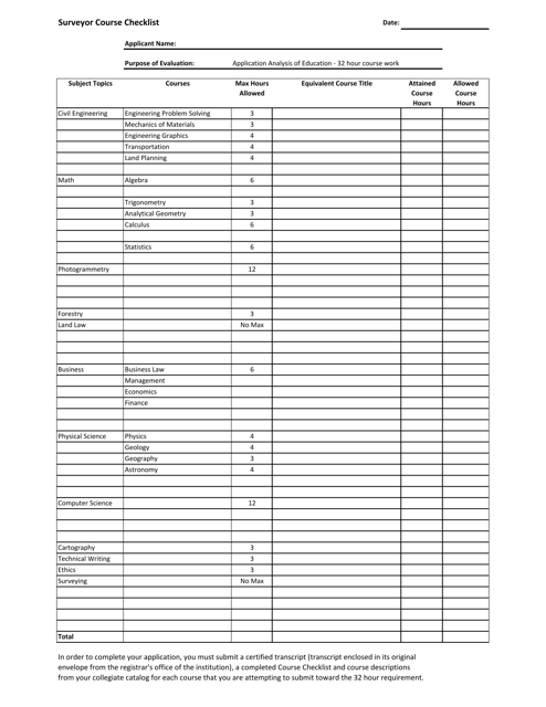
This form is used for applying for subdivision of land or changing the use of an existing property in Prince Edward Island, Canada.
This form is used to request closure of a land surveying firm in the state of Texas.
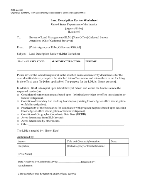
This document is a checklist for the surveyor course in Texas. It outlines the requirements and steps needed to complete the course and become a certified surveyor in the state of Texas.
This Form is used for designating the acreage of a property in the state of Texas.
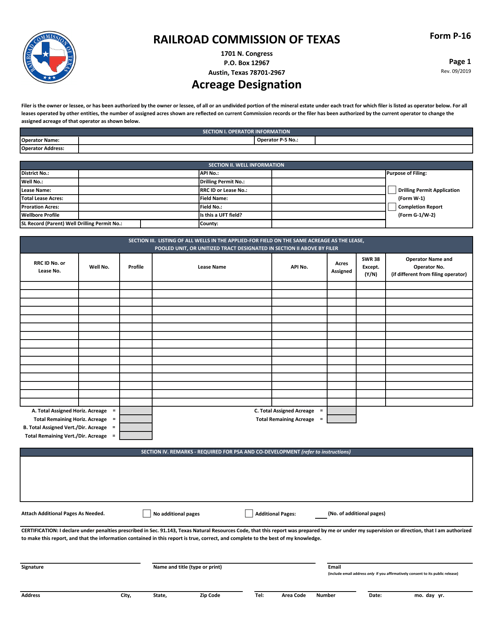
This form is used for certifying substandard acreage in Texas.
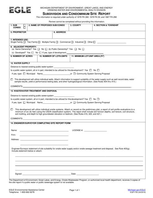
This document is used for the assignment of the right-of-way in the state of Louisiana. It is a legal agreement that transfers the rights to use a designated area for a specific purpose, such as constructing or accessing a road or pipeline.
This form is used for submitting a Subdivision and Condominium Site Report in the state of Michigan. It provides information about the proposed development and its compliance with subdivision and condominium regulations.
This document is used to apply for certification as a property mapper in the state of North Carolina. It is the initial application for individuals interested in becoming certified in this field.
This Form is used for reinstating a Land Surveyor B License in Virginia.
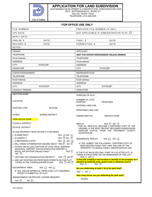
This document is an application form for requesting permission to subdivide land in the City of Dallas, Texas.
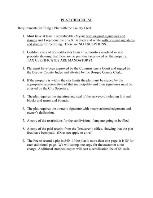
This document is a checklist specific to Bosque County, Texas. It is used for keeping track of tasks and items related to property maintenance or moving in the county.
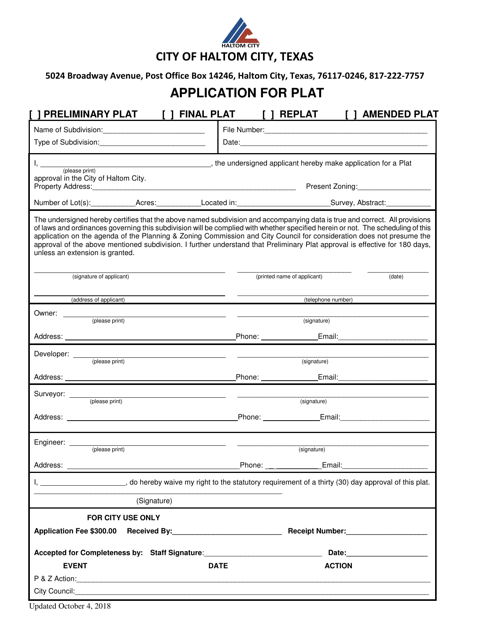
This document is an application for a plat in Haltom City, Texas. It is used by individuals or companies who wish to establish a new plat or make changes to an existing plat in Haltom City.
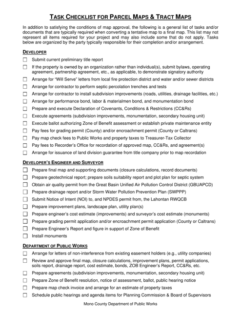
This document is a task checklist specifically for Parcel Maps and Tract Maps in Mono County, California. It provides a detailed list of tasks and steps to be followed in the process of creating and maintaining these types of maps in the county.
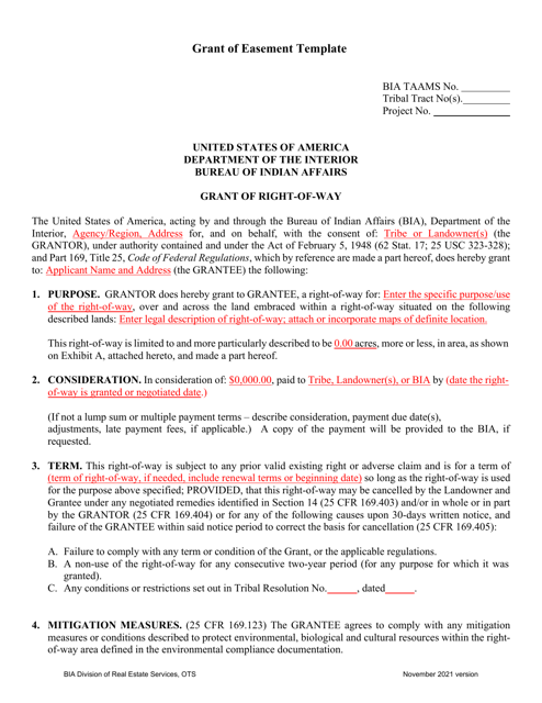
This document is a template that is used to grant an easement, which is the legal right to use someone else's property for a specific purpose.
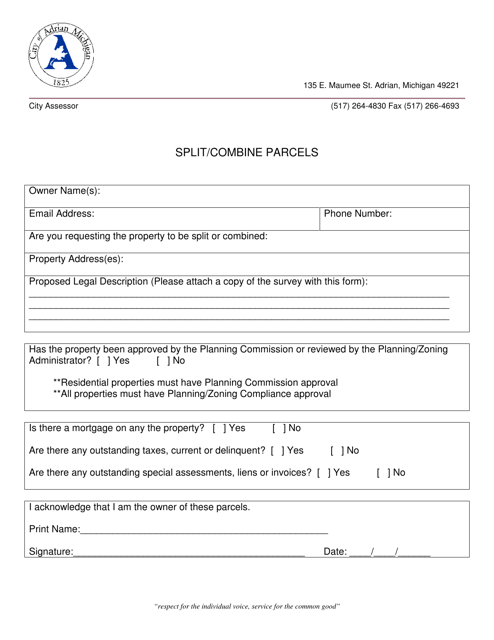
This document is for residents in the City of Adrian, Michigan who want to split or combine parcels of land. It provides information on the process and requirements for doing so.
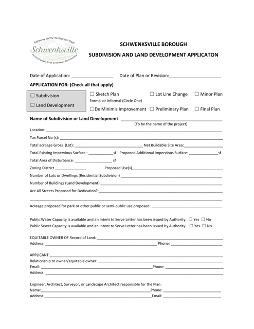
This document is a Subdivision and Land Development Application specific to Schwenksville Borough in Pennsylvania. It is used to apply for the division of land and any proposed development within the borough.
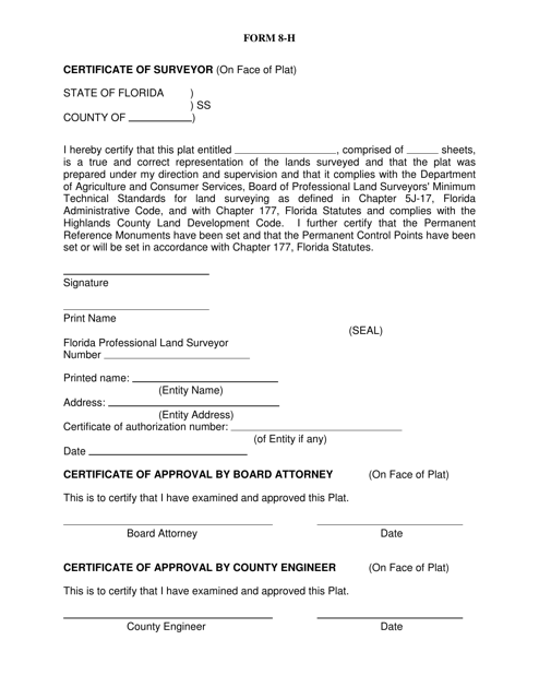
This Form is used for obtaining a certificate of surveyor in Highlands County, Florida. It is necessary for property owners to ensure accurate land boundaries.
